|
| Mesoscale Discussion 598 |
|
[an error occurred while processing this directive]
|

|
   Mesoscale Discussion 0598
   NWS Storm Prediction Center Norman OK
   0306 AM CDT Tue Apr 29 2025

   Areas affected...southwest Oklahoma into northwest Texas

   Concerning...Severe potential...Watch unlikely

   Valid 290806Z - 291000Z

   Probability of Watch Issuance...20 percent

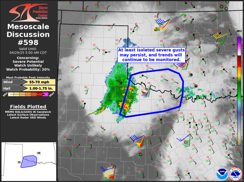
   SUMMARY...A few strong to severe gust may occur from northwest Texas
   into southwest Oklahoma this morning. The situation may not require
   a watch.

   DISCUSSION...An MCS is rapidly moving eastward into northwest TX,
   with several gusts over 50 kt recently. Radar indicates the leading
   edge of this convective line remains strong and well balanced. Given
   a moist and unstable air mass downstream, it is expected this system
   will persist for a few more hours. However, longevity may also
   depend on capping. At the very least, isolated severe gusts may
   occur. Trends will continue to be monitored.

   ..Jewell/Mosier.. 04/29/2025

   ...Please see www.spc.noaa.gov for graphic product...

   ATTN...WFO...FWD...OUN...SJT...LUB...

   LAT...LON   34309996 34709984 34819944 34939822 34759773 34489756
               34019759 33569772 33399840 33180004 33270030 34309996

   MOST PROBABLE PEAK WIND GUST...55-70 MPH
   MOST PROBABLE PEAK HAIL SIZE...1.00-1.75 IN
|
|
Top/All Mesoscale Discussions/Forecast Products/Home
|
|


