|
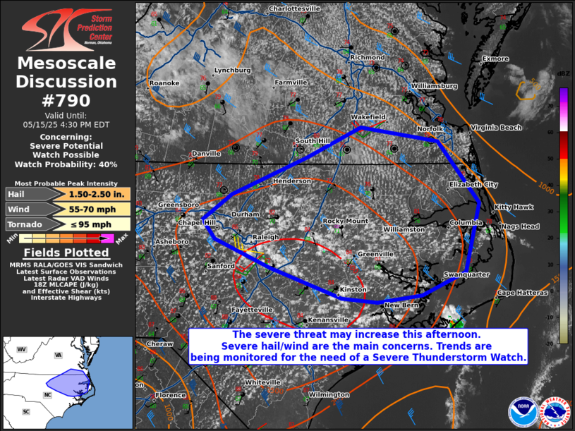
| Mesoscale Discussion 790 |
|
[an error occurred while processing this directive]
|

|
   Mesoscale Discussion 0790
   NWS Storm Prediction Center Norman OK
   0157 PM CDT Thu May 15 2025

   Areas affected...portions of central and northeast North Carolina
   into far southeast Virginia

   Concerning...Severe potential...Watch possible

   Valid 151857Z - 152030Z

   Probability of Watch Issuance...40 percent

   SUMMARY...The severe threat may be increasing across portions of
   central and northeast NC into far southeast VA. If storms can mature
   and sustain themselves, severe wind/hail may occur. Convective
   trends are being monitored for the need of a Severe Thunderstorm
   Watch.

   DISCUSSION...An agitated CU field is evident across portions of
   central NC, where a heated/mixed boundary layer beneath the eastward
   extent of an EML supports over 3000 J/kg MLCAPE. Strong
   west-northwesterly mid-level flow is also beginning to overspread
   the region, contributing to over 35 kts of effective bulk shear,
   which should only increase further into the afternoon. Kinematic and
   thermodynamic fields in place support multicells and supercells
   should storms mature and become sustained, with severe hail/wind
   being the main concerns. Questions remain how robust and widespread
   convective coverage will become. As such, convective trends are
   being monitored for greater storm coverage and the subsequent need
   of a Severe Thunderstorm Watch.

   ..Squitieri/Mosier.. 05/15/2025

   ...Please see www.spc.noaa.gov for graphic product...

   ATTN...WFO...AKQ...MHX...RAH...

   LAT...LON   35477604 35247656 35177711 35217754 35517841 35797908
               35987923 36247888 36607796 36907730 36767636 36167587
               35477604

   MOST PROBABLE PEAK TORNADO INTENSITY...UP TO 95 MPH
   MOST PROBABLE PEAK WIND GUST...55-70 MPH
   MOST PROBABLE PEAK HAIL SIZE...1.50-2.50 IN
|
|
Top/All Mesoscale Discussions/Forecast Products/Home
|
|


