|
| Mesoscale Discussion 921 |
|
[an error occurred while processing this directive]
|
|
Mesoscale Discussion 0921
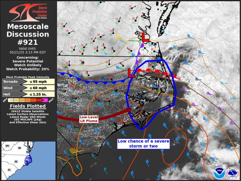
NWS Storm Prediction Center Norman OK
1148 AM CDT Wed May 21 2025
Areas affected...far eastern North Carolina
Concerning...Severe potential...Watch unlikely
Valid 211648Z - 211915Z
Probability of Watch Issuance...20 percent
SUMMARY...Isolated strong storms may develop this afternoon over far
eastern North Carolina. Localized hail or wind may occur.
DISCUSSION...Surface analysis shows a low over northeast
NC/southeast VA, with a cold front extending westward across
northern NC. South of this front, westerly winds and strong heating
are steepening boundary layer lapse rates, and removing convective
inhibition. Meanwhile, a narrow zone of mid 70s F dewpoints remains
in place over far eastern NC. Continued heating will yield over 2000
J/kg MLCAPE, beneath moderate westerlies aloft with around 50 kt
deep layer shear.
Although the westerly flow regime will eventually result in a drying
air mass, a window may exist in the near term for a few strong to
severe storms. Isolated marginal hail or a strong downburst cannot
be ruled out.
..Jewell/Guyer.. 05/21/2025
...Please see www.spc.noaa.gov for graphic product...
ATTN...WFO...AKQ...MHX...
LAT...LON 36217671 36417640 36457580 36337571 36037553 35587539
35237548 35037602 34697635 34577651 34627665 34937691
35447704 35837695 36217671
MOST PROBABLE PEAK TORNADO INTENSITY...UP TO 95 MPH
MOST PROBABLE PEAK WIND GUST...UP TO 60 MPH
MOST PROBABLE PEAK HAIL SIZE...UP TO 1.25 IN
|
|
Top/All Mesoscale Discussions/Forecast Products/Home
|
|


 @NWSSPC