Mesoscale Discussion 1192
NWS Storm Prediction Center Norman OK
1129 PM CDT Sat Jun 07 2025
Areas affected...ArkLaTex into parts of northern MS/AL
Concerning...Severe Thunderstorm Watch 389...
Valid 080429Z - 080600Z
The severe weather threat for Severe Thunderstorm Watch 389
continues.
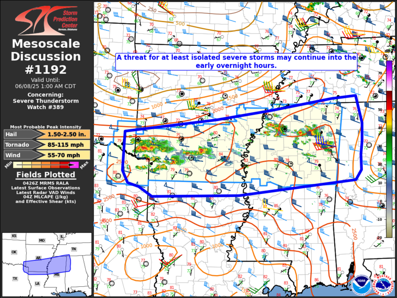
SUMMARY...A threat for at least isolated severe storms may continue
into the early overnight hours.
DISCUSSION...Widely scattered strong to potentially severe storms
are ongoing in a corridor from southern AR into northern MS. The
environment remains favorable for supercells, with rich low-level
moisture, MLCAPE of greater than 2000 J/kg, and 40+ kt of effective
shear. However, midlevel lapse rates are rather weak with warm
temperatures aloft, and most storms thus far have struggled to
maintain severe intensity. Some increase in storm coverage remains
possible with time within a modest low-level warm-advection regime,
including the potential for occasional supercells with a threat of
hail, locally damaging wind, and possibly a tornado.
With time, some severe threat may spread out of WW 389 to the east
and south. Some local expansion of WW 389 may eventually be needed
(where possible), but additional watch issuance into a less unstable
environment across AL is uncertain, and will depend on short-term
observational trends as storms approach the edge of the watch.
..Dean/Gleason.. 06/08/2025
...Please see www.spc.noaa.gov for graphic product...
ATTN...WFO...OHX...BMX...HUN...MEG...JAN...LZK...SHV...
LAT...LON 34259480 34609199 34849030 35128843 35188766 34488750
34008752 33688756 33288757 33028775 32669129 32619392
32859433 32939467 33249483 34259480
MOST PROBABLE PEAK TORNADO INTENSITY...85-115 MPH
MOST PROBABLE PEAK WIND GUST...55-70 MPH
MOST PROBABLE PEAK HAIL SIZE...1.50-2.50 IN
|


 @NWSSPC