|
| Mesoscale Discussion 1227 |
|
[an error occurred while processing this directive]
|
|
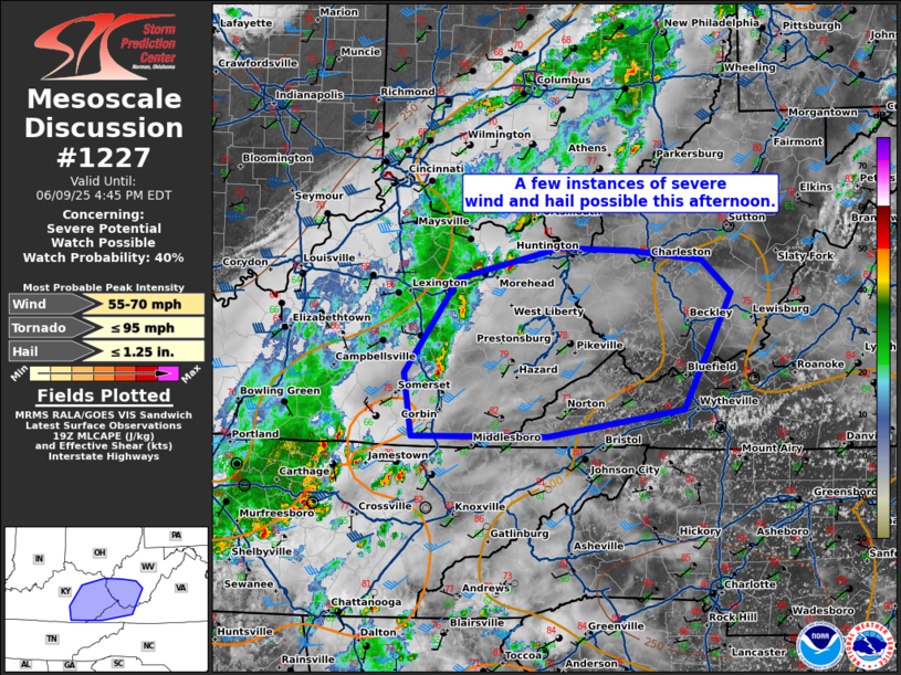
   Mesoscale Discussion 1227
   NWS Storm Prediction Center Norman OK
   0211 PM CDT Mon Jun 09 2025

   Areas affected...eastern Kentucky...southern West Virginia...far
   western Virginia

   Concerning...Severe potential...Watch possible

   Valid 091911Z - 092045Z

   Probability of Watch Issuance...40 percent

   SUMMARY...Thunderstorms to continue eastward with a few instances of
   severe wind and hail possible.

   DISCUSSION...Thunderstorm activity continues eastward across
   portions of central/eastern Kentucky this afternoon. This has
   largely remained sub-severe, however, temperatures have warmed into
   the mid 70s to 80s ahead to this broken line, with MLCAPE around
   250-500 J/kg. Flow across this region is generally weak. Deep layer
   shear around 25-30 kts may be sufficient for some organized segments
   capable of damaging wind. Given the weak flow for support, a watch
   is not likely to be needed but trends will be monitored through the
   afternoon/evening.

   ..Thornton/Mosier.. 06/09/2025

   ...Please see www.spc.noaa.gov for graphic product...

   ATTN...WFO...RNK...RLX...MRX...JKL...LMK...

   LAT...LON   37288451 38168387 38458267 38428182 38348100 38028067
               36938122 36688282 36698441 37288451

   MOST PROBABLE PEAK TORNADO INTENSITY...UP TO 95 MPH
   MOST PROBABLE PEAK WIND GUST...55-70 MPH
   MOST PROBABLE PEAK HAIL SIZE...UP TO 1.25 IN
|
|
Top/All Mesoscale Discussions/Forecast Products/Home
|
|


 @NWSSPC