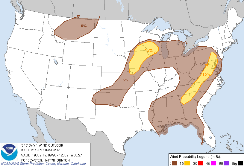
Probability of damaging thunderstorm winds or wind gusts of 50 knots or higher within 25 miles of a point. Hatched Area: 10% of greater probability of wind gusts 65 knots or greater within 25 miles of a point.
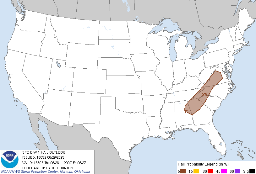
Probability of hail 1" or larger within 25 miles of a point. Hatched Area: 10% or greater probability of hail 2" or larger within 25 miles of a point.
Day 1 Hail Risk
Area (sq. mi.)
Area Pop.
Some Larger Population Centers in Risk Area
5 %
70,171
13,626,969
Atlanta, GA...Winston-Salem, NC...Sandy Springs, GA...Roanoke, VA...Roswell, GA...
SPC AC 261609
Day 1 Convective Outlook
NWS Storm Prediction Center Norman OK
1109 AM CDT Thu Jun 26 2025
Valid 261630Z - 271200Z
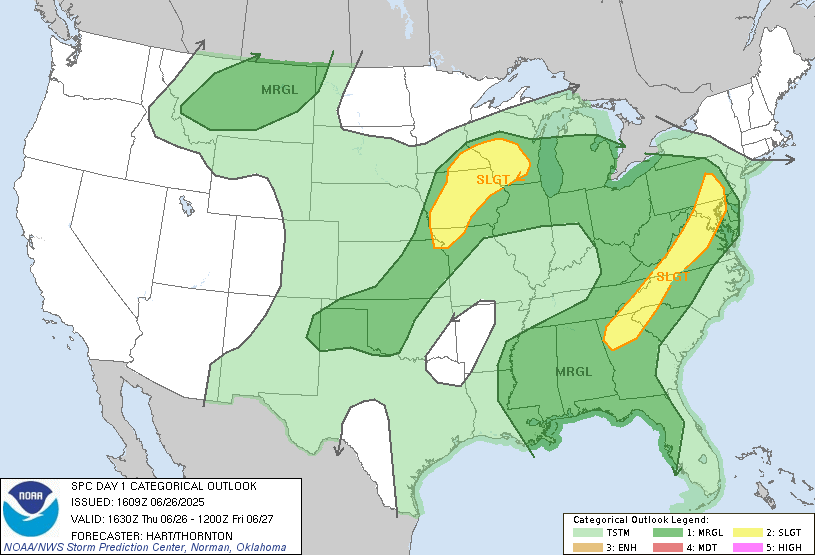
...THERE IS A SLIGHT RISK OF SEVERE THUNDERSTORMS THIS AFTERNOON
FROM NORTHWEST MO INTO SOUTHERN MN/WI...AND FROM THE MID-ATLANTIC TO
THE SOUTHERN APPALACHIANS...
...SUMMARY...
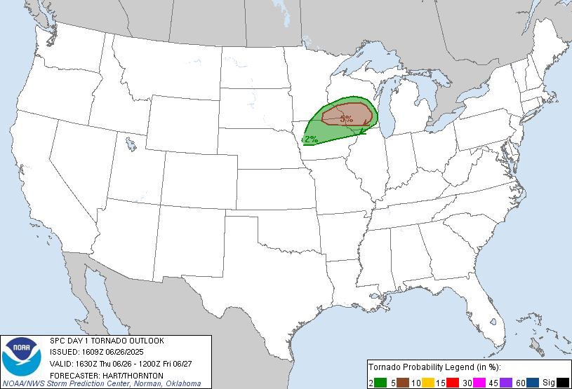
Isolated wind damage and a few tornadoes will be possible this
afternoon from northwest Missouri into Iowa, southeast Minnesota,
and southern Wisconsin. Scattered wind damage will be possible from
the Mid-Atlantic into the southern Appalachians.
...Upper Midwest...
A shortwave trough is evident this morning over NE/SD moving
eastward. Lift ahead of this feature will encourage scattered
thunderstorm development by early afternoon near the surface low and
along a weak cold front over western IA. These storms will track
southeastward into a warm and very moist air mass, where MLCAPE
values will be 2000-3000 J/kg. Steep low-level lapse rates will
promote a risk of damaging winds as the storms spread southeastward
through early evening.
From the surface low eastward into southern WI, a corridor of backed
low-level winds and enhanced shear along the warm front will be
favorable for a few discrete supercells. Similar to yesterday
(although perhaps not quite as favorable), there is a risk of a few
tornadoes through the afternoon and early evening.
...Mid-Atlantic to Southern Appalachians...
Full sunshine is occurring again today from southeast PA to the
western Carolinas and north GA. This corridor will be hot/humid
again today, leading to scattered thunderstorms. Winds aloft are
weak, suggesting disorganized/pulse convective modes. However,
steep low-level lapse rates and moderate CAPE values will once again
result in a risk of locally damaging wind gusts through the
afternoon and early evening. Despite the expected weak winds aloft,
will introduce a SLGT risk for this corridor given the consensus of
model guidance supporting the threat.
..Hart/Thornton.. 06/26/2025
NOTE: THE NEXT DAY 1 OUTLOOK IS SCHEDULED BY 2000Z