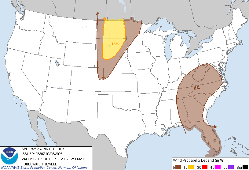
Probability of damaging thunderstorm winds or wind gusts of 50 knots or higher within 25 miles of a point. Hatched Area: 10% of greater probability of wind gusts 65 knots or greater within 25 miles of a point.
Rapid City, SD...North Platte, NE...Watertown, SD...Brookings, SD...Dickinson, ND...
SPC AC 260530
Day 2 Convective Outlook
NWS Storm Prediction Center Norman OK
1230 AM CDT Thu Jun 26 2025
Valid 271200Z - 281200Z
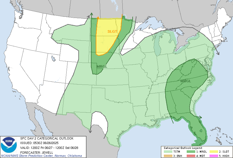
...THERE IS A SLIGHT RISK OF SEVERE THUNDERSTORMS OVER THE NORTHERN
PLAINS...
...SUMMARY...
Severe storms producing large hail and locally damaging winds are
forecast over parts of the northern Plains Friday afternoon and
evening. Sporadic damaging gusts may also occur over parts of the
Mid Atlantic and Southeast.
...Synopsis...
A low amplitude trough will move across the northern Rockies and
into the northern Plains on Friday, with 40+ kt 500 mb winds into
the Dakotas. As this occurs, a surface trough will develop over the
western Dakotas, providing a focus for thunderstorms during the day.
To the east, a weaker wave will move from lower MI into the lower
Great Lakes, with a surface low enhancing convergence/lift. The air
mass will remain moist and unstable over much of the central and
eastern CONUS, supporting scattered storms over much of the area.
The strongest instability is expected over the northern Plains in
advance of the upper system. Otherwise, a weak upper low will remain
over GA/FL providing cool midlevel temperatures and aiding daytime
storm development.
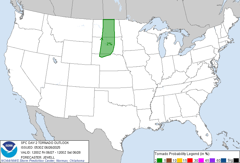
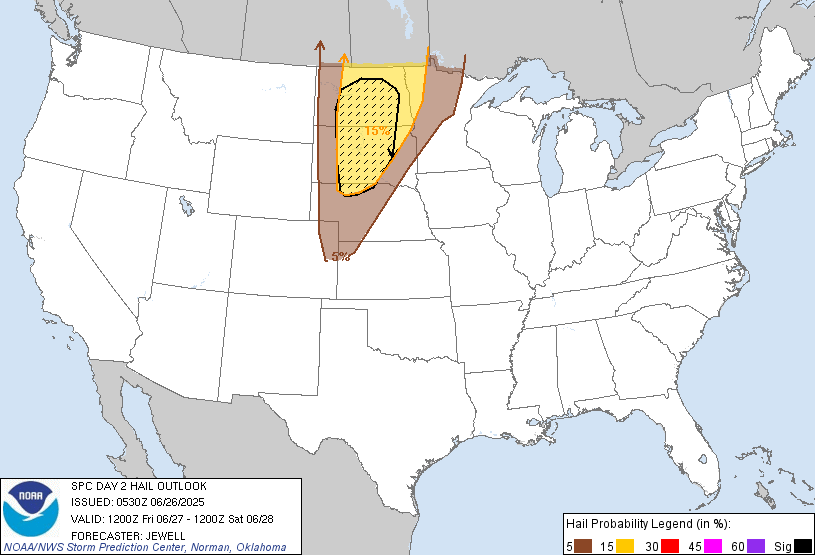
...Northern Plains...
Strong heating will lead to an uncapped air mass within the surface
trough, with scattered areas of storms developing from northeast CO
into western NE and from the western into the central Dakotas.
Supercells are most likely across the Dakotas beneath the stronger
flow aloft, with the strongest cells producing very large hail and
perhaps a brief tornado. Farther south across NE, CO and KS, deep
mixed layers should favor strong outflow and localized wind damage.
Storms may increase again during the evening over eastern ND and
northern MN with increasing southwest flow at 850 mb late.
...Southeast and Mid Atlantic...
A weak surface trough will develop from VA across the Carolinas and
into GA with strong heating. A moist and unstable air mass will
again favor areas of thunderstorms beneath the upper ridge. Lapse
rates aloft and therefore total instability will not be as strong as
previous days, but widely scattered strong to damaging gusts may
still occur during the afternoon across the entire region.
..Jewell.. 06/26/2025
NOTE: THE NEXT DAY 2 OUTLOOK IS SCHEDULED BY 1730Z