|
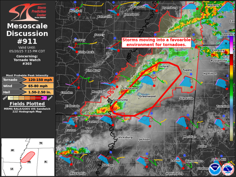
| Mesoscale Discussion 911 |
|
[an error occurred while processing this directive]
|

|
   Mesoscale Discussion 0911
   NWS Storm Prediction Center Norman OK
   0538 PM CDT Tue May 20 2025

   Areas affected...Parts of northern Mississippi

   Concerning...Tornado Watch 303...

   Valid 202238Z - 210015Z

   The severe weather threat for Tornado Watch 303 continues.

   SUMMARY...Several ongoing severe storms are moving into an
   increasingly favorable environment for tornadoes across northern
   Mississippi.

   DISCUSSION...A couple semi-discrete supercells are tracking eastward
   across parts of northwest/west-central MS. Ahead of these storms, a
   35-kt low-level jet (sampled by area VWPs) is contributing to ample
   low-level clockwise hodograph curvature with around 200 m2/s2
   effective SRH. Given warm/moist surface-based inflow and this
   enhanced streamwise vorticity, the ongoing storms may intensify as
   they continue eastward -- with an increasing tornado risk. Large
   hail and locally damaging winds will also be a concern.

   ..Weinman.. 05/20/2025

   ...Please see www.spc.noaa.gov for graphic product...

   ATTN...WFO...MEG...JAN...

   LAT...LON   33249113 34288996 34538945 34538915 34428884 34208873
               33278969 33019032 33029069 33099102 33249113

   MOST PROBABLE PEAK TORNADO INTENSITY...120-150 MPH
   MOST PROBABLE PEAK WIND GUST...65-80 MPH
   MOST PROBABLE PEAK HAIL SIZE...1.50-2.50 IN
|
|
Top/All Mesoscale Discussions/Forecast Products/Home
|
|


