Note:
The expiration time in the watch graphic is amended if the watch is
replaced, cancelled or extended.
Note:
Note:
The expiration time in the watch graphic is amended if the watch is
replaced, cancelled or extended.
Note: Click for
Watch Status Reports.
   SEL4

   URGENT - IMMEDIATE BROADCAST REQUESTED
   Tornado Watch Number 234
   NWS Storm Prediction Center Norman OK
   135 PM CDT Tue May 6 2025

   The NWS Storm Prediction Center has issued a

   * Tornado Watch for portions of
     Louisiana
     East Texas

   * Effective this Tuesday afternoon and evening from 135 PM until
     900 PM CDT.

   * Primary threats include...
     A few tornadoes likely with a couple intense tornadoes possible
     Scattered damaging winds likely with isolated significant gusts
       to 75 mph possible
     Isolated very large hail events to 2 inches in diameter possible

   SUMMARY...A line of thunderstorms with embedded supercells will
   spread eastward over east Texas into Louisiana this afternoon and
   evening. Main threats will be tornadoes and severe/damaging winds. A
   strong tornado or two will be possible with any supercell that can
   persist along/ahead of the ongoing thunderstorms. Isolated large
   hail may also occur.

   The tornado watch area is approximately along and 90 statute miles
   north and south of a line from 10 miles west southwest of Lufkin TX
   to 25 miles northeast of Alexandria LA. For a complete depiction of
   the watch see the associated watch outline update (WOUS64 KWNS
   WOU4).

   PRECAUTIONARY/PREPAREDNESS ACTIONS...

   REMEMBER...A Tornado Watch means conditions are favorable for
   tornadoes and severe thunderstorms in and close to the watch
   area. Persons in these areas should be on the lookout for
   threatening weather conditions and listen for later statements
   and possible warnings.

   &&

   OTHER WATCH INFORMATION...CONTINUE...WW 231...WW 232...WW 233...

   AVIATION...Tornadoes and a few severe thunderstorms with hail
   surface and aloft to 2 inches. Extreme turbulence and surface wind
   gusts to 65 knots. A few cumulonimbi with maximum tops to 500. Mean
   storm motion vector 24035.

   ...Gleason
 Note:
The Aviation Watch (SAW) product is an approximation to the watch area.
The actual watch is depicted by the shaded areas.
Note:
The Aviation Watch (SAW) product is an approximation to the watch area.
The actual watch is depicted by the shaded areas.
   SAW4
   WW 234 TORNADO LA TX 061835Z - 070200Z
   AXIS..90 STATUTE MILES NORTH AND SOUTH OF LINE..
   10WSW LFK/LUFKIN TX/ - 25NE ESF/ALEXANDRIA LA/
   ..AVIATION COORDS.. 80NM N/S /10W LFK - 35NE AEX/
   HAIL SURFACE AND ALOFT..2 INCHES. WIND GUSTS..65 KNOTS.
   MAX TOPS TO 500. MEAN STORM MOTION VECTOR 24035.

   LAT...LON 32489491 32969200 30359200 29879491

   THIS IS AN APPROXIMATION TO THE WATCH AREA.  FOR A
   COMPLETE DEPICTION OF THE WATCH SEE WOUS64 KWNS
   FOR WOU4.
Watch 234 Status Report Messages:
STATUS REPORT #6 ON WW 234
VALID 070125Z - 070200Z
SEVERE WEATHER THREAT CONTINUES RIGHT OF A LINE FROM 15 W LCH TO
25 NNW LCH TO 40 SSE ESF.
PARTS OF REMAINING VALID PORTION OF WW MAY BE LOCALLY EXTENDED IN
TIME FOR AN HOUR BEYOND 07/02.
..KERR..05/07/25
ATTN...WFO...LCH...SHV...
&&
STATUS REPORT FOR WT 234
SEVERE WEATHER THREAT CONTINUES FOR THE FOLLOWING AREAS
LAC001-045-055-097-099-101-113-070200-
LA
. LOUISIANA PARISHES INCLUDED ARE
ACADIA IBERIA LAFAYETTE
ST. LANDRY ST. MARTIN ST. MARY
VERMILION
$$
THE WATCH STATUS MESSAGE IS FOR GUIDANCE PURPOSES ONLY. PLEASE
REFER TO WATCH COUNTY NOTIFICATION STATEMENTS FOR OFFICIAL
INFORMATION ON COUNTIES...INDEPENDENT CITIES AND MARINE ZONES
CLEARED FROM SEVERE THUNDERSTORM AND TORNADO WATCHES.
$$
STATUS REPORT #5 ON WW 234
VALID 070035Z - 070140Z
SEVERE WEATHER THREAT CONTINUES RIGHT OF A LINE FROM 35 ESE UTS
TO 20 E ESF.
..KERR..05/07/25
ATTN...WFO...LCH...SHV...
&&
STATUS REPORT FOR WT 234
SEVERE WEATHER THREAT CONTINUES FOR THE FOLLOWING AREAS
LAC001-003-009-011-019-023-039-045-053-055-079-097-099-101-113-
070140-
LA
. LOUISIANA PARISHES INCLUDED ARE
ACADIA ALLEN AVOYELLES
BEAUREGARD CALCASIEU CAMERON
EVANGELINE IBERIA JEFFERSON DAVIS
LAFAYETTE RAPIDES ST. LANDRY
ST. MARTIN ST. MARY VERMILION
$$
TXC199-241-245-351-361-457-070140-
TX
. TEXAS COUNTIES INCLUDED ARE
HARDIN JASPER JEFFERSON
NEWTON ORANGE TYLER
$$
THE WATCH STATUS MESSAGE IS FOR GUIDANCE PURPOSES ONLY. PLEASE
REFER TO WATCH COUNTY NOTIFICATION STATEMENTS FOR OFFICIAL
INFORMATION ON COUNTIES...INDEPENDENT CITIES AND MARINE ZONES
CLEARED FROM SEVERE THUNDERSTORM AND TORNADO WATCHES.
$$
STATUS REPORT #4 ON WW 234
VALID 062330Z - 070040Z
SEVERE WEATHER THREAT CONTINUES RIGHT OF A LINE FROM 10 WSW LFK
TO 35 NW POE TO 15 E IER TO 40 NNE ESF.
..KERR..05/06/25
ATTN...WFO...LCH...SHV...
&&
STATUS REPORT FOR WT 234
SEVERE WEATHER THREAT CONTINUES FOR THE FOLLOWING AREAS
LAC001-003-009-011-019-023-039-043-045-053-055-059-079-097-099-
101-113-115-070040-
LA
. LOUISIANA PARISHES INCLUDED ARE
ACADIA ALLEN AVOYELLES
BEAUREGARD CALCASIEU CAMERON
EVANGELINE GRANT IBERIA
JEFFERSON DAVIS LAFAYETTE LA SALLE
RAPIDES ST. LANDRY ST. MARTIN
ST. MARY VERMILION VERNON
$$
TXC199-241-245-351-361-457-070040-
TX
. TEXAS COUNTIES INCLUDED ARE
HARDIN JASPER JEFFERSON
NEWTON ORANGE TYLER
$$
THE WATCH STATUS MESSAGE IS FOR GUIDANCE PURPOSES ONLY. PLEASE
REFER TO WATCH COUNTY NOTIFICATION STATEMENTS FOR OFFICIAL
INFORMATION ON COUNTIES...INDEPENDENT CITIES AND MARINE ZONES
CLEARED FROM SEVERE THUNDERSTORM AND TORNADO WATCHES.
$$
STATUS REPORT #3 ON WW 234
VALID 062305Z - 070040Z
SEVERE WEATHER THREAT CONTINUES RIGHT OF A LINE FROM 10 W LFK TO
30 WNW IER TO 10 S MLU.
..KERR..05/06/25
ATTN...WFO...LCH...SHV...
&&
STATUS REPORT FOR WT 234
SEVERE WEATHER THREAT CONTINUES FOR THE FOLLOWING AREAS
LAC001-003-009-011-019-021-023-039-043-045-053-055-059-069-079-
085-097-099-101-113-115-127-070040-
LA
. LOUISIANA PARISHES INCLUDED ARE
ACADIA ALLEN AVOYELLES
BEAUREGARD CALCASIEU CALDWELL
CAMERON EVANGELINE GRANT
IBERIA JEFFERSON DAVIS LAFAYETTE
LA SALLE NATCHITOCHES RAPIDES
SABINE ST. LANDRY ST. MARTIN
ST. MARY VERMILION VERNON
WINN
$$
TXC005-199-241-245-351-361-403-405-457-070040-
TX
. TEXAS COUNTIES INCLUDED ARE
ANGELINA HARDIN JASPER
JEFFERSON NEWTON ORANGE
SABINE SAN AUGUSTINE TYLER
$$
THE WATCH STATUS MESSAGE IS FOR GUIDANCE PURPOSES ONLY. PLEASE
REFER TO WATCH COUNTY NOTIFICATION STATEMENTS FOR OFFICIAL
INFORMATION ON COUNTIES...INDEPENDENT CITIES AND MARINE ZONES
CLEARED FROM SEVERE THUNDERSTORM AND TORNADO WATCHES.
$$
STATUS REPORT #2 ON WW 234
VALID 062135Z - 062240Z
SEVERE WEATHER THREAT CONTINUES RIGHT OF A LINE FROM 25 NNW LFK
TO 25 E SHV TO 35 SSW ELD.
..KERR..05/06/25
ATTN...WFO...LCH...SHV...
&&
STATUS REPORT FOR WT 234
SEVERE WEATHER THREAT CONTINUES FOR THE FOLLOWING AREAS
LAC001-003-009-011-013-019-021-027-031-039-043-049-053-055-059-
061-069-073-079-081-085-097-111-115-127-062240-
LA
. LOUISIANA PARISHES INCLUDED ARE
ACADIA ALLEN AVOYELLES
BEAUREGARD BIENVILLE CALCASIEU
CALDWELL CLAIBORNE DE SOTO
EVANGELINE GRANT JACKSON
JEFFERSON DAVIS LAFAYETTE LA SALLE
LINCOLN NATCHITOCHES OUACHITA
RAPIDES RED RIVER SABINE
ST. LANDRY UNION VERNON
WINN
$$
TXC005-199-241-245-347-351-361-403-405-419-457-062240-
TX
. TEXAS COUNTIES INCLUDED ARE
ANGELINA HARDIN JASPER
JEFFERSON NACOGDOCHES NEWTON
ORANGE SABINE SAN AUGUSTINE
SHELBY TYLER
$$
THE WATCH STATUS MESSAGE IS FOR GUIDANCE PURPOSES ONLY. PLEASE
REFER TO WATCH COUNTY NOTIFICATION STATEMENTS FOR OFFICIAL
INFORMATION ON COUNTIES...INDEPENDENT CITIES AND MARINE ZONES
CLEARED FROM SEVERE THUNDERSTORM AND TORNADO WATCHES.
$$
STATUS REPORT #1 ON WW 234
VALID 062045Z - 062140Z
SEVERE WEATHER THREAT CONTINUES RIGHT OF A LINE FROM 40 NW LFK TO
35 ESE GGG TO 35 NNW SHV.
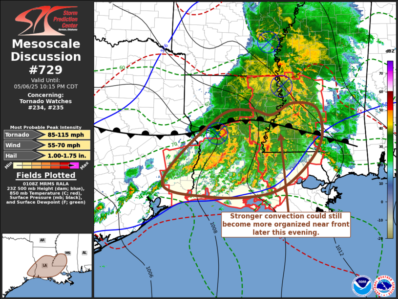
FOR ADDITIONAL INFORMATION SEE MESOSCALE DISCUSSION 723
..WEINMAN..05/06/25
ATTN...WFO...LCH...SHV...
&&
STATUS REPORT FOR WT 234
SEVERE WEATHER THREAT CONTINUES FOR THE FOLLOWING AREAS
LAC001-003-009-011-013-015-017-019-021-027-031-039-043-049-053-
055-059-061-069-073-079-081-085-097-111-115-119-127-062140-
LA
. LOUISIANA PARISHES INCLUDED ARE
ACADIA ALLEN AVOYELLES
BEAUREGARD BIENVILLE BOSSIER
CADDO CALCASIEU CALDWELL
CLAIBORNE DE SOTO EVANGELINE
GRANT JACKSON JEFFERSON DAVIS
LAFAYETTE LA SALLE LINCOLN
NATCHITOCHES OUACHITA RAPIDES
RED RIVER SABINE ST. LANDRY
UNION VERNON WEBSTER
WINN
$$
TXC005-073-199-241-245-347-351-361-365-403-405-419-457-062140-
TX
. TEXAS COUNTIES INCLUDED ARE
ANGELINA CHEROKEE HARDIN
JASPER JEFFERSON NACOGDOCHES
NEWTON ORANGE PANOLA
SABINE SAN AUGUSTINE SHELBY
TYLER
$$
THE WATCH STATUS MESSAGE IS FOR GUIDANCE PURPOSES ONLY. PLEASE
REFER TO WATCH COUNTY NOTIFICATION STATEMENTS FOR OFFICIAL
INFORMATION ON COUNTIES...INDEPENDENT CITIES AND MARINE ZONES
CLEARED FROM SEVERE THUNDERSTORM AND TORNADO WATCHES.
$$
Note:
Click for Complete Product Text.
Tornadoes
Probability of 2 or more tornadoes
|
Mod (60%)
|
Probability of 1 or more strong (EF2-EF5) tornadoes
|
Mod (40%)
|
Wind
Probability of 10 or more severe wind events
|
Mod (60%)
|
Probability of 1 or more wind events > 65 knots
|
Mod (30%)
|
Hail
Probability of 10 or more severe hail events
|
Mod (30%)
|
Probability of 1 or more hailstones > 2 inches
|
Mod (30%)
|
Combined Severe Hail/Wind
Probability of 6 or more combined severe hail/wind events
|
High (80%)
|
For each watch, probabilities for particular events inside the watch
(listed above in each table) are determined by the issuing forecaster.
The "Low" category contains probability values ranging from less than 2%
to 20% (EF2-EF5 tornadoes), less than 5% to 20% (all other probabilities),
"Moderate" from 30% to 60%, and "High" from 70% to greater than 95%.
High values are bolded and lighter in color to provide awareness of
an increased threat for a particular event.


 @NWSSPC